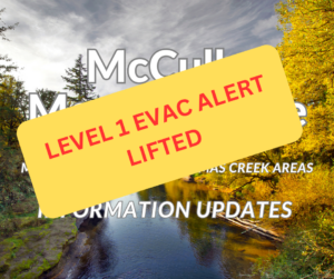
**UPDATE** LEVEL 1 (BE READY) Alert Lifted for McCully Mtn/Thomas Creek Fire – September 11, 2023 @ 10:50 a.m.
 The LEVEL 1 (BE READY) Evacuation Preparedness Alert issued last night for the McCully Mountain and Thomas Creek Drive areas is lifted. Overnight conditions were favorable for fire crews, and the Oregon Department of Forestry – North Cascade District has established good lines all the way around the fire. Crews are in mop-up mode today. The fire’s current size is contained to 15 acres.
(OLD INFO FROM 09/20/23)
McCully Mountain/Thomas Creek Fire Burning at Eight Acres – Level 1 (BE READY) Issued
The Oregon Department of Forestry – North Cascade District is working an eight-acre fire southwest of McCully Mountain. The fire is past the locked gates of Thomas Creek Drive, and in remote terrain. As a precaution, Fire Incident Command and Sheriff Michelle Duncan are issuing a LEVEL 1 (BE READY) Evacuation Preparedness Alert for the following area:
Beginning at the intersection of South Cedar Mill Rd and Trask Road, south to Thomas Creek, traversing the creek west to where Bear Creek dumps into Thomas Creek, then north to the intersection of South McCully Mountain Road and East McCully Mountain Road, encompassing all residences on both sides of both South McCully Mountain Road and East McCully Mountain Road. For more specifics, visit: https://tinyurl.com/LinnCoFireMap
While the areas within a LEVEL 1 (BE READY) Evacuation Preparedness Alert remain open, persons living or visiting the LEVEL 1 area should stay alert and prepared, as evacuation levels can change with fire conditions quickly and alerts may not be able to be delivered to cell phones in the area.
At this time, no sheltering for persons or animals is being established, but area residence are encouraged to make plans for evacuation of themselves and their animals, should the situation change.
For more information on evacuations, visit https://www.linnsheriff.org/ and @LinnSheriff .
Important Links:
Linn County Wildfire Map: https://tinyurl.com/LinnCoFireMap
Air & Smoke Map: https://fire.airnow.gov/
Oregon Department of Forestry – North Cascade District: https://www.facebook.com/odfnorthcascade